Building a brand through inspiring photos of the outdoors

Tom Parker, Photographer and Instagram Influencer

Tom Parker, Photographer and Instagram Influencer

Growing your Instagram account to just over 87 thousand followers doesn’t happen over night. But for Tom Parker, Photographer and Instagram Influencer, it didn’t take too long. The Vancouver Island-based photographer has grown his following to over 87 thousand followers after 846 inspiring posts to go explore the outdoors. With minimal use of hashtags, Tom uses Instagram to showcase his work in nature landscapes across Vancouver Island and the world.

Tom’s work is a reflection of his lifestyle and passions, gaining a unique perspective from his surroundings. He has worked with Destination BC, Vancouver Island University, Telus, Oru Kayak, Tourism Nanaimo, Mizu and Kuhl Clothing.

I asked Tom to answer a few questions about his experience using Instagram, which he has successfully utilized to grow his own brand…

As a photographer, what was your first impression of Instagram?
Instagram (IG) is one of the reasons I’m a photographer today. When IG was first introduced, I wasn’t that interested in the app and I didn’t even download it. Over a year later we were on a hike and my friend was taking pictures for his IG account. Not knowing too much about the app, I asked him about it and slowly became interested in the sharing and community aspect of Instagram. A year later and I was using Instagram daily and have been ever since.

Tell us about your journey to 87k followers on Instagram.
At first I didn’t really know what I was going to post to my IG account. I shot anything and everything, trying to figure out what I liked to shoot the most. I eventually realized that I wanted to express my passion for living outdoors through photography. From there people seemed to appreciate and connect with my images. It’s great to see that there are people just as passionate as me about nature.

Is there an Instagram filter you frequently use?
Most of my editing is done on Lightroom, but if I do use an Instagram filter it’s usually Juno or Ludwig.

A sleepy morning at Spirit Island

A sleepy morning at Spirit Island by Tom Parker

What is the biggest benefit you have gotten from Instagram?
Some of the biggest advantages of using Instagram for me are the ability to make new connections and form working relationships with like-minded people and businesses that have a passion for the outdoors. Instagram’s platform has made it easy for clients and businesses to discover photographers that align with their brand, opening up new avenues for marketing.

Do you follow a posting schedule or strategy?
I try and post once a day, as for a time I’m not sure it matters as much as it use to. Instagram’s old algorithm for running your feed was time sensitive, the more time that passes the further down the feed a photo would go. With the new algorithm it’s based off what Instagram feels you will “like” based off of your interactions with the app. This means that if you are engaging with some accounts more than others they will show up closer to the top of your feed, regardless of the time they posted.

What advice do you have for someone who is just starting out on Instagram?Try and get out shooting as much as possible, over time you will figure out what works for you and develop your own style. Its also important to post consistently. I try for one post a day or more. Consistency in the content of the posts also seems to be beneficial when trying to grow your account. If people follow you for outdoor related content then that is what they are expecting and want to see.

Where do you see Instagram heading in the next five years?
That’s the big question, it is hard to tell what is going to happen to Instagram in the future. Will it lose its popularity over time and die out with many other social media apps? Or will it be able to adapt and change accordingly to the market? I think Instagram has a good chance of surviving the battle of time and keep its popularity. The reason I think it has a good chance of surviving is that Instagram is owned by Facebook, which has been able to maintain one of the top spots in social media for over twelve years, staying ahead of their competitors. But with all the different types of apps coming out such as Snapchat, its hard to tell what will be the next big thing.

Follow Tom Parker on Instagram for more incredible image of the outdoors.

Posted in Things to Do, Uncategorized | Tagged , , , , , , , , , , , | 1 Comment

Follow the Footprints

IMG_2521This weekend we hiked the Bedwell Lake Trail in Strathcona Park. It’s still a little early in the year and we may have been the first hikers up there this season (or since the last snowfall). The forecast looked promising with blue skies and high temperatures.

The Bedwell Lake Trail is accessed from Highway 28 from Campbell River, heading towards Gold River, you continue along the highway past the Gold River turn off along Buttle Lake.

IMG_2472We set off from the trailhead late in the morning and enjoyed the 4.2 kilometre trail across the suspension bridge, through the mossy forest and rugged terrain for the first section of the trail. As we gained elevation, snow covered more parts of the trail to the point where it was hard to recognize where the trail was. Thankfully, Simon had a GPS to guide us through the snow. As we reached higher elevations, we were hiking on five feet of packed snow. Due to the warm weather and water flow, some parts of the snow had melted from underneath, making it dangerous to walk on with the possibility of falling through. This happened to me as I was walking along the trail, I felt through the snow about four and a half feet!

IMG_2486Approaching Baby Bedwell Lake, there was a deep upper snow pack and it was a little more difficult to trek through (we didn’t bring snowshoes), even though this area was more exposed to the sun. It would be a great place for snowshoeing!

We still had a great time and some of the snow by the creek had melted so there was still a source for fresh water.

IMG_2492
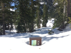
When we reached Baby Bedwell Lake, the text pads were nowhere to be seen (hidden by over six feet of snow) but the view of the snow-covered Baby Bedwell Lake and Mt Tom Taylor were spectacular.

We skipped the extra six kilometres to Cream Lake and stopped for a lunch break before heading back to the trailhead. It was warm sitting on the snow in the sun watching small packs of snow slide off the rock. One day I would love to hike from Cream Lake, over Mt Septimus to Love Lake, following the Della Falls trail back to Great Central Lake.

IMG_2494

Baby Bedwell Lake

The hike back was much easier to navigate as we just followed our footprints in the snow back to the trailhead. I wouldn’t have attempted this trail if we didn’t have a GPS to show that we were still on the trail. It would be easy to get lost with all the snow covering most parts of the trail. There is also no cell reception in this part of the park.

We decided to camp at Buttle Lake Campground. After we set up our tents and ate dinner, we warmed up with baileys and hot chocolate in front of a small campfire.

IMG_2515


If you enjoyed this blog post, you might be interested in hiking to one of the tallest waterfalls in Canada – another incredible hike in Strathcona Park!  

Posted in Hiking, Recreation, Things to Do | Tagged , , , , , , , , , , , , , , | 2 Comments

Searching for hidden treasures

I tried geocaching for the first time recently. Not only did we discover a beautiful new trail, we found several little hidden treasures along the way!

IMG_2094

Leaving Nanaimo early in the morning, we set out for the Nile Creek trailhead. We pulled on to the shoulder of the highway (19) right after the Nile Creek Bridge near Qualicum Beach, just one of the access points for this trail. The trail winds down under the overpass and into the lush moss-covered trees. The path was in great shape and with the sunshine during the week, it wasn’t very muddy.

One person in our group, the geocaching maven, had a GPS to tell us how far we were from each geocache on the trail. Walking along the creek, we kept an eye out for the hidden treasures, some trickier to find than others. Sometimes clues are provided, and within a few minutes we found it! Most caches, at least the ones that I have found so far, have been a small tupperware container filled with a pen and notebook for geocachers to leave their code name (mine is Mudkins), along with little trinkets or items for trading. IMG_2131

We walked for about 45 minutes, stopping a few times to find four geocaches until reaching the top of the gushing waterfall, falling about 35 feet into an enclosed swim hole, ideal for a hot summer’s day swim.

One great thing about geocaching is that it forces you to be aware of your surroundings and it’s a great way to discover new trails.

After all of the hikes I have accomplished across Vancouver Island, I wonder how many little hidden treasures I have unknowingly passed….

IMG_2140

Posted in Hiking, Things to Do, Uncategorized | Tagged , , , , , , , , , , | 2 Comments

Far from home

This post is inspired by the WordPress daily blog prompt: Far From Home

I was 22 years old. I wasn’t happy. Working in a job that was going nowhere, I started to feel like my life was losing purpose. I was living in Victoria (British Columbia) at the time, and trying to figure out where my life was going. I didn’t know what kind of career I wanted to pursue. I felt lost. I knew there was more out there, I just didn’t know what “out there” was or had to offer. The city I lived in didn’t feel like home; it was a displacement, like a tiger in a zoo.

Josh, a co-worker who I chatted with regularly, always told me I was too young to be working as a receptionist and that I needed to explore the world. He and his wife were planning a sailing trip to Australia, and invited me along. The thought of sailing across the world was something unimaginable to me. Yet, I loved exploring new places and I needed a change. Luckily, I had very little responsibilities holding me back, and so the planning began.

In the wake of my excitement, I had some trepidation about going on this trip. I had spent many weekends on our family boat, but I had never been on a sailboat. I wondered if I would survive weeks on the unprotected waves of the ocean so far from home.

“At this point, I was too far to let this wanderlust dream die.”

Only a few week later, Josh shared some disappointing news with me. They decided to cancel their sailing trip and buy a home on Pender Island. I was bummed. At this point, I was too far to let this wanderlust dream die. Within a month, I handed in my resignation and bought a one-way ticket to Sydney, Australia.

200287_6456135342_194_n copy

I had a couple months to plan my trip, and I boarded the plane the day after Christmas. That ticket was the best Christmas gift I had ever bought myself.

I ended up spending a year backpacking around Australia. I could write many blog posts just on my experiences. During that year, I found my identity, tested my strengths, experienced new things, pushed myself to my limits and met endless people.

I still keep in touch with several of the people I met on that trip, friends who I’ve built a relationship with over the years and some who became good travel companions.

There were times where I felt very alone and far from home. But those experiences helped make me a stronger person, and I am grateful for that.

I lost touch with Josh. When I returned from my trip, he had moved on to another company. I never got to thank him for pushing me to find what I was looking for, and to let him know how much he had changed my life….

I spent a two and a half months living on the Kangaroo Explorer, a liveaboard dive boat on the Great Barrier Reef. Photo by Luke Grimer.

I spent two and a half months living on the Kangaroo Explorer, a liveaboard dive boat on the Great Barrier Reef. Photo by Luke Grimer.

The Great Ocean Road

Driving along the Great Ocean Road

197030_6456145342_5454_n

Bondi Beach, New South Wales

Posted in Travel | Tagged , , , , , , , , , , , , , | 1 Comment

5 stress-free things to do at Mystic Beach

Imagine a place far from the city noise where the only sound is crashing waves. There is no cell reception and the path to get there is vibrant shades of green within old growth forrest. Mystic Beach is my nostalgic island escape. It is one of my favourite places on Vancouver Island for west coast camping (there are also 78 campsites at China Beach with washroom facilities). IMG_0530

Between Sooke and Port Renfrew, access to Mystic Beach is at the second China Beach entrance – the Juan de Fuca East trailhead (kilometre zero of the Juan de Fuca Trail). Follow the 2.5 kilometre trail of intertwined tree roots to Mystic Beach. Along the way,  you will cross two suspension bridges. The trail is easy and well maintained.

As the ultimate place to unwind, I have created a list of five ways to de-stress at this magical place:

IMG_0396Conquer the suspension bridge
Be adventurous. Don’t be afraid to push your limits and discover a new path that takes you somewhere you have never been. The best places are the hardest ones to get to.


IMG_0422Soak up the rays with a great book
On my first hiking trip (the 47 km Juan de Fuca Trail in 2004) I read my John Grisham out loud to my hiking buddy and as we read through the book, we burned the pages to save us that extra tenth of an ounce in weight.

IMG_0419Play on the rope swing
Test your strength and climb the rope as you swing back and forth on the beach. This rope has been hanging from the tree for more than 10 years.

IMG_0413Run barefoot in the waves
There is something liberating about running barefoot in the sand as the ocean waves wash up on the sandy beach; leaving a brief trail until a new wave washes it away.

IMG_0406

Look for whales as the sun sets
During spring and summer months, there is a good chance of spotting grey whales as they migrate north. Orcas are also frequently seen along the west coast.

Things to remember:
There is a bear cache at Mystic Beach. Bears frequently roam the area so be respectful towards other campers and leave all your food in the food cache.

Also, don’t forget to check the tide conditions before you go. In winter months, the tide is higher than usual.


If you plan to visit Mystic Beach, get there by taking the Pacific Marine Circle Route.

Posted in Hiking, Recreation, Things to Do, Uncategorized | Tagged , , , , , , , , , , , , | 2 Comments

Snow motivation

A little snow won’t stop me from breathing the fresh mountain air. In fact, the scenic winter wonderland motivates me to get outside during the winter months. The snow covered trees and glistening icicles are magical. Even with the little amount of snow we get here on Central Vancouver Island, you don’t have to go very far to experience it.  IMG_1788

There is an extensive network of trails along Westwood Ridge (Mount Benson) in Nanaimo. Many of the trails are used by mountain biking enthusiasts and hikers. Access points include Westwood Lake and Witchcraft Lake.

Westwood Ridge offers stunning views of Mount Benson and leads you to a beautiful  lookout of Nanaimo and the coastal mountains. This hike takes less than an hour. Most of the trail is through the forrest, but as you ascend, it becomes a little more exposed. The lookout is a great picnic spot. IMG_1759

Along the way, there is an incredible memorial site of two young men, one who died in a cabin that burned down in 2008, and the other who had helped build the cabin. Not far from the memorial site is a covered BBQ station that was built in their memory.

Snow shoes weren’t required on this hike as half the trail didn’t have snow and closer to the lookout the snow was packed down from previous hikers. The snow at the top was about four inches deep (as of December 29, 2015). I prefer hiking the trails when the snow is packed down – you’re less likely to trip over a tree root and puddles are infrequent. You may want to check the weather conditions beforehand. IMG_1766

This is a great little winter hike that doesn’t take up much time in your day and the view is almost as good as the Mount Benson summit. Watch for little signs on the trees. They’ll point you in the direction of the summit trail…. or shenanigans.

Happy hiking!


If you enjoyed this post, you will probably like The Best View of Nanaimo


Posted in Hiking, Nanaimo, Recreation, Things to Do | Tagged , , , , , , , , , , , , , , , | Leave a comment

Vancouver Island’s Wine Country

Did you know that British Columbia’s second largest wine region is located here on Vancouver Island? There are 35 wineries on the Island and 16 of them are in the Cowichan Valley. Back in late September, I organized a day tour with a few friends through Vancouver Island Expeditions. While we couldn’t experience all of the wineries in one day, it gives us a great reason to plan another tour next year. We left it up to Leif, our knowledgeable tour guide, to lead us to the best wineries… and he did.

Our first stop on the Cowichan wine tour was Cherry Point Estate Wines. The previous day this winery had roughlIMG_0998y 370 visitors. Whether it was from the award-winning wines or the complimentary sangria on the patio, this was a pleasing stop for the palate. I highly recommend the Blackberry Port Dessert Wine. Xavier Bonilla, owner and wine connoisseur, believes blending is an art and takes time. Cherry Point Estate Wines has over 21 years of doing just that, with about 12 blends available this year. In 1994, it became one of the first licensed wineries on Vancouver Island.

Our second stop was Unsworth Vineyards, where you will find 12 acres of grape varieties… and chickens wandering around! Did you know that one acre of vineyard (1,500 vines) results in three tonnes of grapes, which then turns inIMG_1003to just enough for seven barrels of wine? And one barrel equals 288 bottles of wine. That is a year’s supply for some people I know.

Lunch was included at the Unworths restaurant that overlooks the rolling vineyards. We shared a variety of small plates. The chickpea fries and the grilled lamb leg didn’t last long!

Our next stop was Enrico Winery. Hello Duchess! Every person on the wine tour bought a bottle of the Duchess Estate Reserve Pinot Gris (2014), and I will buy it again. Enrico strategically produced only 100 cases, creating a demand for the distinguished tastes of crisp apple, pear and citrus.

IMG_1008On to the next stop! Merridale Estate Cidery, located in Cobble Hill, has a landscape that depicts a farm, until you see the green vineyards. Tasters for their vodka, gin and brandy were available, but I decided to stick to a few of the ciders (all delicious).

Our final stop was Averill Creek Vineyard. Another scenic countryside landscape. By this point our palate enjoyed everything we tasted, especially the Gewürztraminer (2014). Lively notes of lychee and sweet apple-pear with a hint of zesty lime makes it easy to drink. Warm summer afternoons are an ideal place for a glass of wine on the garden patio.

IMG_8265Overall, the day exceeded by expectations. My experience in touring wineries is limited to a day in Naramata, part of BC’s largest wine region, so I’m by far no expert. But the number of award-winning wines from this region, locally and internationally, prove there is quality producers in the Cowichan Valley and surrounding region. Vancouver Island’s mild climate also offers prime growing conditions for wineries.

The Cowichan Valley is worth visiting, especially if you have time for an afternoon ice cream break along theIMG_1012 water in Cowichan Bay!

I recommend booking a tour with Vancouver Island Expeditions. It made the day much more enjoyable knowing we had reliable transportation to and from Nanaimo (lunch and wine tastings were included). We also didn’t have to worry about directions or wait times – some wineries can get pretty busy during peak season!

Posted in Things to Do | Tagged , , , , , , , , , , , , , , , , , , , , , , , , | Leave a comment

Hiking to one of the tallest waterfalls in Canada

I recently checked off a hike that was on my bucket list for three years. In mid-October, two friends and I planned a three day hiking trip to Della Falls, one of the tallest waterfalls in Canada.

Heading to the trail head on Great Central Lake

Heading to the trailhead on Great Central Lake

The trailhead begins at the west end of Great Central Lake, eight kilometres off the Pacific Rim Hwy just outside of Port Alberni on the way to Tofino. The trailhead is only accessible by boat, kayak or canoe. We organized a water taxi to take us to the other end of the lake, which is a 40 minute boat ride. Ben Potter, a local resident, offers this service to hikers from April to October.

There are 16 campsites at the trailhead. The trail is approximately 15 kilometres to the base of Della Falls. A good portion of the trail runs along Drinkwater Creek. Part of the trail follows an old logging railway, but some parts have been washed out and there are several dried up creeks that cross the trail. These rocks can be slippery when wet. There are also some bridges and a cable car along the way.

Drinkwater Creek

Drinkwater Creek

We camped on a small beach beside Drinkwater Creek, two kilometres before the designated campsites. It was a beautiful spot, however, there is no bear cache. The flowing creek (looks more like a river in my opinion) is a pristine, turquoise colour. This is where we set up camp for two nights.

I recommend hiking to the base of Della Falls, less than a kilometre from the main camp area. The cascading falls stand  1,456 feet high (444 metres). Discovered by Joe Drinkwater in 1899, who named the falls after his wife, had a gold mining operation where the campsites are located. Remnants of machinery can still be found scattered around.

IMG_1232The following day we hiked up to Love Lake, which is approximately three hours of switch back up towards Mount Septimus. The trail is a little overgrown in some areas with fallen trees that make the path a bit more of a trek. The view point near the top is well worth the hike and Love Lake is even more impressive.

Surrounded by three massive mountains – Big Interior Mountain, Mount Septimus and Nine Peaks, Della Falls is a must-do for avid hikers on Vancouver Island. The remote location is out of cellular range and the clear glacier-fed creeks offer some of the cleanest drinking water on the Island. Della Falls is also accessible from the south end of Buttle Lake, but I have heard it is a grind. IMG_1277

I recommend doing this trip in three days. Bear caches and outhouses are available at the trailhead campsites and near the the base of the falls. Regular backpacking rules apply – what you pack in, you pack out.

Happy hiking!


For more photos from this trip, check out the Della Falls gallery below.

Posted in Hiking, Recreation, Things to Do, Uncategorized | Tagged , , , , , , , , , , , , | 1 Comment

Englishman River Falls: an after work getaway

For those hot summer days that you are stuck in the office, Englishman River Falls is a great spot to head aftIMG_0375er work. Located near Errington (just outside of Parksville), the park offers lots of shade, trails and stunning waterfalls.

There is plenty of room for parking and just over 100 campsites if you want to stay overnight. The tree-covered trails are worth exploring through the old growth forest.

Follow the path over bridges overlooking the canyon, past massive trees and along the river. The roaring upper falls leave a refreshing mist in the air as you walk past them.

If you continue on past the upper falls, you will eventually reach the lower falls and a quiet section of the river, which is a nice spot for a swim and a picnic.

IMG_0355There are bathroom facilities near the parking lot and the park is well maintained.

The last time I was here, there was only a few other people taking advantage of the trails. The park is 207 hectares – lots to explore!


Posted in Recreation, Things to Do | Tagged , , , , , , , , , , | Leave a comment

What is so great about Arbutus trees?

There is something about Arbutus trees that fascinate me. It is the way they grow and how their soft bark peels off in the summer to reveal a smooth, new layer underneath that imitates abstract art. IMG_0303

The giant, mature trees withstand harsh weather conditions, from hot and dry summer days to cooler winter months when the temperature drops to zero. They are often found growing on bluffs, coastlines and rocky landscapes across Vancouver Island and tend to live in areas that lack moisture.

Arbutus trees, otherwise known as the Madrona, have a distinct, twisting figure and grow in all sorts of crooked shapes. Found on the southern west coast of British CoIMG_2174lumbia, it is Canada’s only native broadleaved evergreen tree.

The Arbutus tree does not drop its leaves in the fall, but the red bark flakes off in the summer and exposes a new, smooth layer of green bark. They can grow up to 90 feet tall.

These trees are unique and easy to spot. They are quite common in our region and add to the beauty of our natural Island.


Posted in Uncategorized | Tagged , , , , , , , , , , , | Leave a comment